
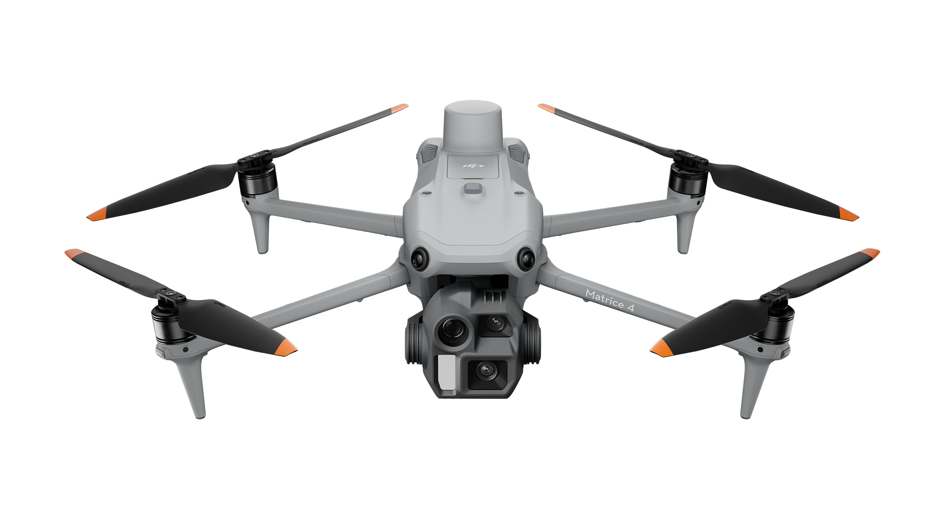
DJI Matrice 4 Series
Flagship Intelligent Multi-Sensor Compact Drone
DJI Matrice 4 Series
The Age of Intelligent Flight
Introducing the DJI Matrice 4 Series – a new compact and intelligent flagship multi-sensor drone lineup for professional use. The series includes two models: Matrice 4T and Matrice 4E, both equipped with advanced features such as smart object detection and laser rangefinder-based measurement. Flight operations are now significantly safer and more reliable thanks to enhanced sensing technologies.
Matrice 4T is ideal for sectors like energy, emergency response, public safety, and forest conservation.
Matrice 4E is designed for geospatial tasks such as mapping, construction, and mining.
Two Models, Countless Applications

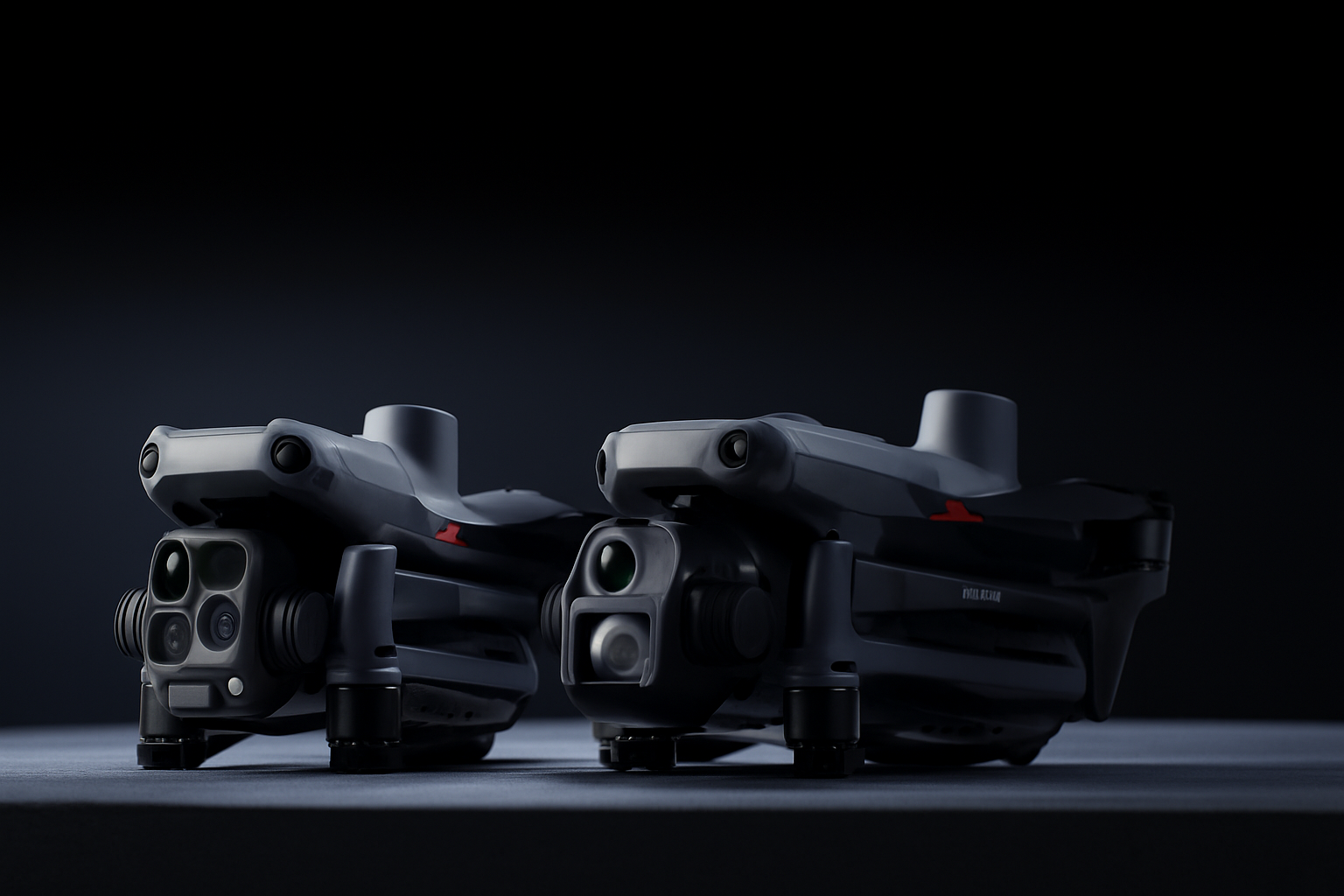
DJI Matrice 4T
Wide-Angle Camera:
1/1.3″ CMOS, 48MP Effective Pixels, f/1.7,
Format Equivalent: 24 mm
Medium Tele Camera:
1/1.3″ CMOS, 48MP Effective Pixels, f/2.8,
Format Equivalent: 70 mm
Tele Camera:
1/1.5″ CMOS, 48MP Effective Pixels, f/2.8,
Format Equivalent: 168 mm
Laser Range Finder:
Measurement Range: 1800 m (1 Hz); Oblique Incidence Range (1:5 Oblique Distance): 600 m (1 Hz) Blind Zone: 1 m; Range Accuracy (m): ± (0.2 + 0.0015 × D)
Infrared Thermal Camera:
Resolution 640 × 512, f/1.0, Equivalent Focal Length: 53 mm, Uncooled VOx Microbolometer, Supports High-Res Mode
NIR Auxiliary Light:
FOV: 6°, Illumination Distance: 100 m

DJI Matrice 4E
Wide-Angle Camera:
4/3 CMOS, 20MP Effective Pixels, f/2.8-f/11,
Format Equivalent: 24 mm, Mechanical Shutter
Medium Tele Camera:
1/1.3″ CMOS, 48MP Effective Pixels, f/2.8,
Format Equivalent: 70 mm
Tele Camera:
1/1.5″ CMOS, 48MP Effective Pixels, f/2.8,
Format Equivalent: 168 mm
Laser Range Finder:
Measurement Range: 1800 m (1 Hz); Oblique Incidence Range (1:5 Oblique Distance): 600 m (1 Hz) Blind Zone: 1 m; Range Accuracy (m): ± (0.2 + 0.0015 × D)
Intelligent Operation Functions

Excel In Low-Light Environments

Clear Vision and Stable Images
High-Efficiency Precision Mapping

Enchanced Flight Safety
Intelligent Operations
Smarter Operations
The built-in model detects vehicles, vessels, and people during rescue or routine flights. It supports model switching for broader use cases, high-res grid photos, and robust tracking.
Laser Range Finder, Precise Measurement
The laser range finder provides real-time precise measurements, marks targets, draws lines, and calculates areas. Data is shared via DJI Pilot QR or FlightHub 2 to boost collaboration.
Observation Range Recording
DJI Pilot 2 highlights the camera frame center and ground area, displaying surveyed zones on the map—ideal for patrols and mountain rescues without clear landmarks.
Efficient Flight, Intelligent Operation
Activate cruise control mode to pilot the drone in a specific direction without constantly pressing the control sticks, making long-distance flights easier.
In emergencies or disasters, the drone can automatically adjust its flight path and speed based on the surrounding environment, allowing it to reach a designated location without manual adjustments.
Smart Track allows for precise subject positioning and automatic zoom adjustments, allowing you to switch between subjects easily. It can automatically reacquire a subject even if obscured briefly.
POI enables continuous observation and 3D modeling of buildings while flying around a designated area, greatly enhancing the efficiency of fixed-point observation and modeling tasks.
Excel In Low-Light Environments
Excel In Low-Light Environments
The Matrice 4 series now features an upgraded night mode with three Full-Color night vision modes and two levels of noise reduction. With an IR Cut Filter and NIR auxiliary light, it ensures clear visibility of search and rescue subjects even in darkness.
Crystal Clear Vision: Unveil the Details
Capture Every Detail at A Distance
Precision Mapping, Time-Saving and Effortless
Rapid 0.5-Second Interval Shooting
The Matrice 4E wide-angle camera supports rapid 0.5-second interval shooting in both orthophoto and oblique photography modes, enabling high-speed aerial surveying from multiple angles. Additionally, the mapping flight speed can reach up to 21 meters per second, [8] significantly enhancing work efficiency.
Smart 3D Capture, Precision Modeling
DJI Matrice 4E supports Smart 3D Capture, which allows you to capture and create a rough model on the remote controller. Based on the rough model, it can quickly generate precise mapping routes close to a structures surface, completing detailed measurements and modeling of irregular buildings. It also supports displaying virtual space routes and waypoint photos for smart 3D capture, making it convenient to assess specific routes' flight safety and coverage area.
Distortion Correction 2.0 provides high-precision in-camera distortion correction with residual distortion less than 2 pixels. Each Matrice 4E's wide-angle camera is calibrated before leaving the factory, when used with DJI Terra, it significantly improves reconstruction accuracy.
Safe Flight, Worry- Free Operation
Fusion Positioning, Safe Return-to-Home
The Matrice 4 series comes with an integrated DJI RTK module which supports the extended L5 frequency band and features GNSS+Vision Fusion Positioning and Navigation System. It allows for the return-to-home point to be updated through visual positioning, allowing for rapid takeoff within 15 seconds. Even without GNSS signals, it can complete the return-to-home process, effectively overcoming signal obstructions and interference commonly found in urban environments.
Intelligent Guidance, Unobstructed Flight
When the DJI RC Plus 2 Enterprise remote controller is connected to the internet, it can load terrain elevation maps and preload detailed maps. This enables automatic path planning for obstacle avoidance, effectively managing scenarios such as flying at night or through mountainous areas, ensuring the safety of flight operations. The drone has a 5-directional vision assist view system along with downward vision, which aids in providing comprehensive visibility for enhanced protection.
Achieve New Heights in Video Transmission
The O4 Enterprise video transmission system sets a new industry standard for challenging environments. Thanks to the 8-antenna system in the Matrice 4 Series and the high-gain antenna in the remote controller, you can achieve up to 25 kilometers in transmission range. Furthermore, the system improves image transmission with a download bandwidth of 20MB/s, more than double the bitrate of the Mavic 3 Enterprise Series, ensuring more precise and stable images of route uploads and material downloads.
DJI Matrice 4 Series
The Age of Intelligent Flight
Contact Us
If you’d like to learn more about our product demo or trial, please share your contact details in the form below.