
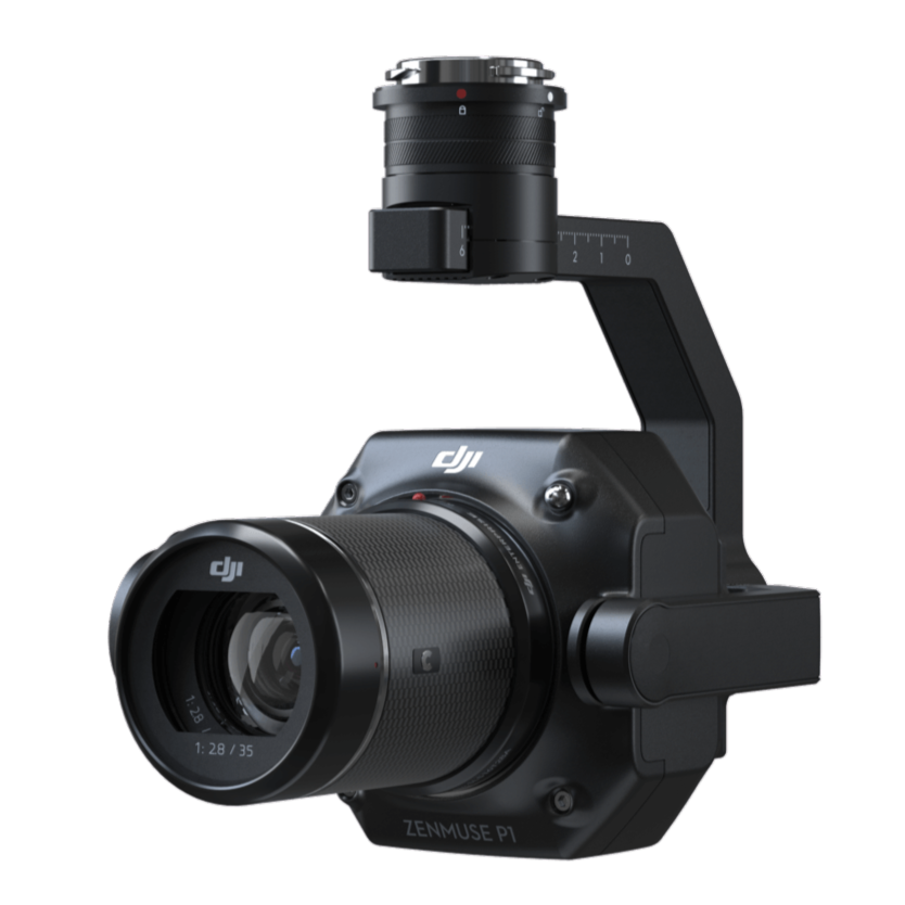
Zenmuse P1

Zenmuse P1
Efficiency through Flexible Full-frame Photogrammetry
The New Benchmark for Aerial Surveying
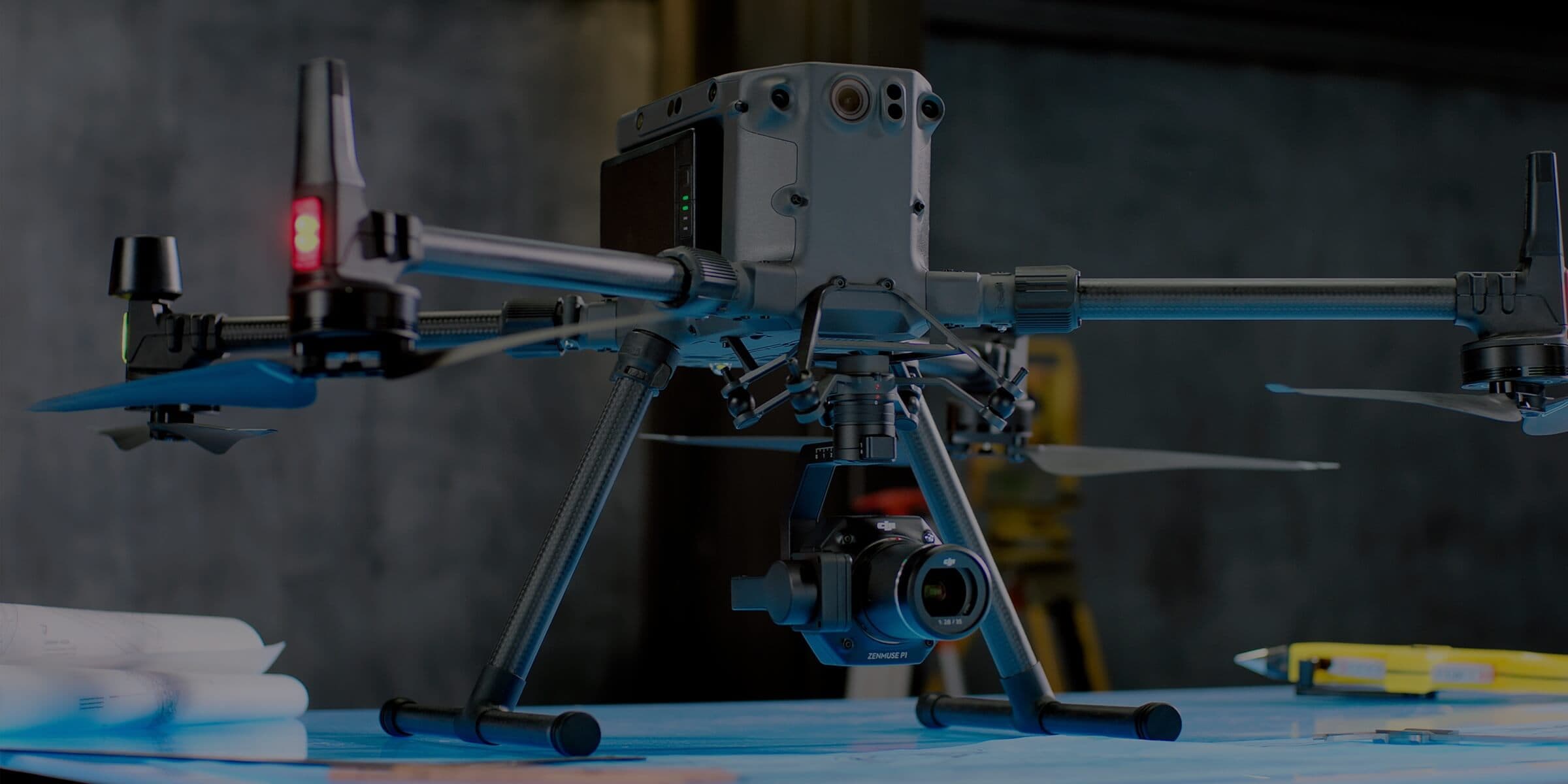
The Zenmuse P1 integrates a full-frame sensor with interchangeable fixed-focus lenses on a 3-axis stabilized gimbal. Designed for photogrammetry flight missions, it takes efficiency and accuracy to a whole new level.
Accuracy without GCPs 3 cm horizontally / 5 cm vertically
High Efficiency 3 km2 covered in a single flight
45 MP Full-frame Sensor
3-axis Stabilized Gimbal Smart Oblique Capture
Global Mechanical Shutter Shutter Speed 1/2000 Seconds
TimeSync 2.0 - synchronization at the microsecond level
Your Go-to Tool for Aerial Photogrammetry


Extraordinary Efficiency
The P1 includes a full-frame, low-noise high-sensitivity sensor that can take a photo every 0.7 s during the flight, and covering 3 km2 in a single flight.
Full-frame Camera
Efficiency to Cover It All

Multiple Fixed-focus Lens Options
Flexibility to Capture It All


Work Smart, Work Fast
Work Smart, Work Fast
Smart Oblique Capture
Coverage:
Up to 7.5 km² in a single workday with the P1
Smart Oblique Capture:
Increases efficiency of oblique photography missions
Automatic Gimbal Rotation:
Captures photos at required angles
Optimized Shooting:
Only essential photos taken at flight edges
Post-Processing Efficiency:
Improved by 20%–50%
Smart Data Management
Your mission data management - streamlined.
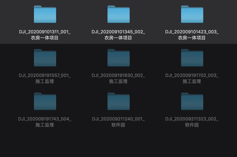
Mission result files are automatically associated with the Mission Name and Mission Time.
A centralized storage location for photos, GNSS data, and TimeStamps. MRK files.
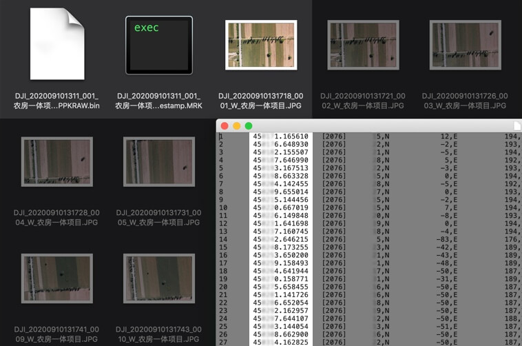
The image metadata contains the camera’s intrinsic and extrinsic parameters and the status of RTK.
Fieldwork Report
Verify data quality immediately post-flight by checking the position data and number of the images acquired, as well as RTK status and positioning accuracy.


A Mission Mode for Any Scenario
A Mission Mode for Any Scenario
Generate orthomosaics without GCPs using the P1, perfect for medium to large-area operations.
Effortlessly acquire oblique images from multiple angles that meet 3D modeling requirements across industries such as urban planning and centimeter-level accurate cadastral surveys to serve 3D reality models and smart city planning.
Acquire ultra-high resolution image data of vertical or slanted surfaces from a safe distance that faithfully recreates fine textures, structures, and features, for detailed reconstructions, geological surveys, heritage site conservation, hydraulic engineering, and more.
Gather geographic information of large areas in real-time using DJI Terra so that teams can make crucial decisions quickly on site.
Zenmuse P1
Efficiency through Flexible Full-frame Photogrammetry
Contact Us
If you’d like to learn more about our product demo or trial, please share your contact details in the form below.