
DJI Matrice 400
Long-Endurance Drone Platform With Power-Line-Level Obstacle Sensing
DJI Matrice 400
Engineered for Excellence, Designed for Versatility

Up to 59 minutes of flight time for extended missions without interruptions.
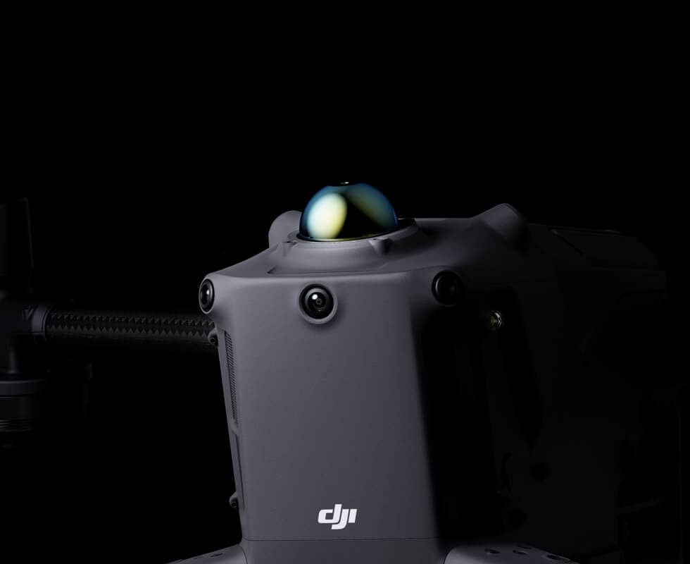
mmWave radar detects aerial obstacles, enhancing flight safety.
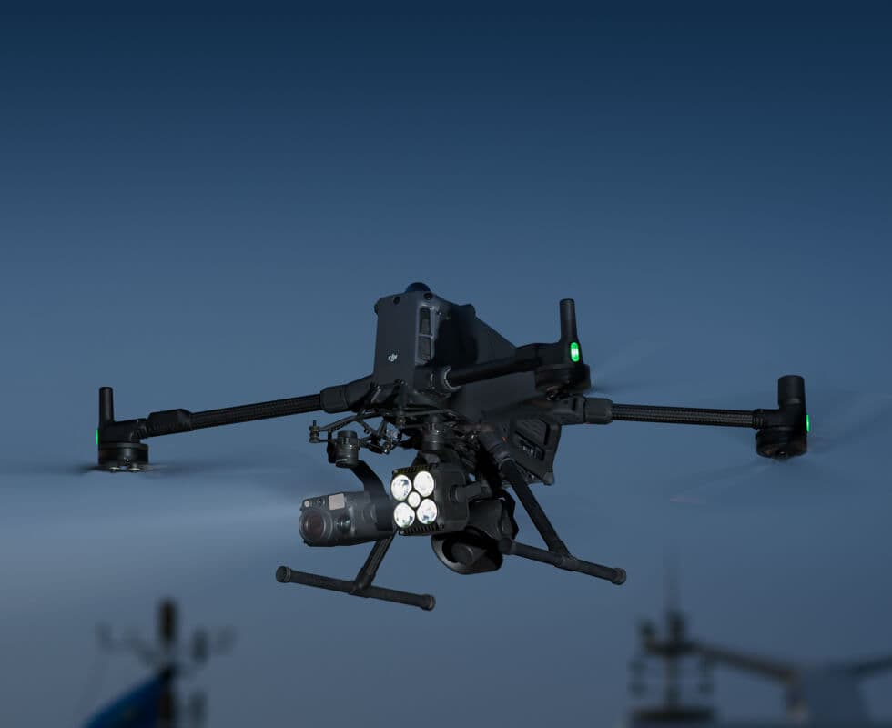
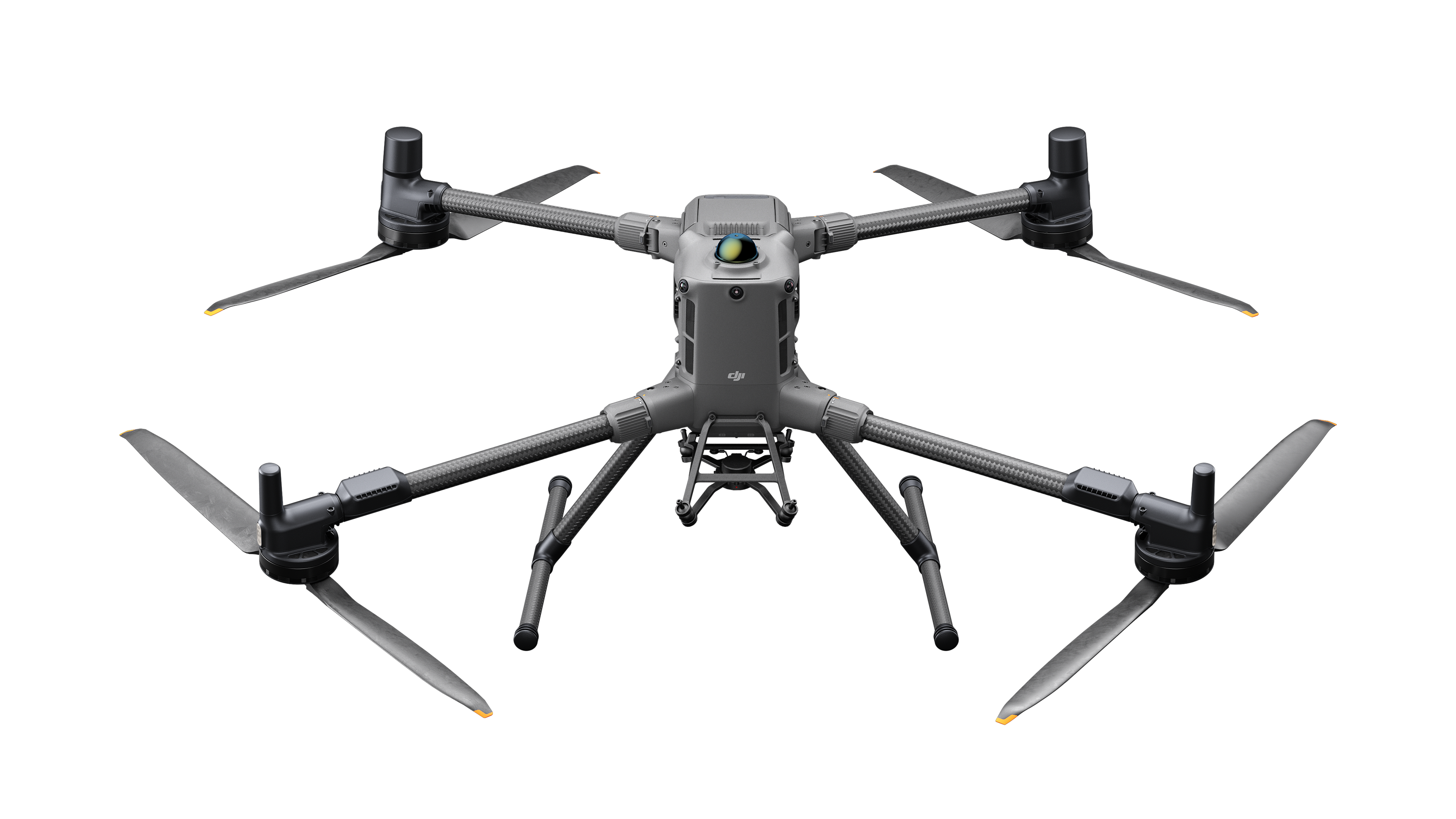
Supports up to 6 kg payload for versatile professional gear.
Integrated rotating LiDAR for precise 3D terrain scanning in any conditions.
Integrated rotating LiDAR for precise 3D terrain scanning in any conditions.
Advanced Technologies and Automation
Extended Flight Time, High Speed Performance
Up to 6 kg Payload Capacity
Safe and Reliable Flight
Enchenced Intelligence and Efficiency
Automated Operations

Extended Flight Time, High Speed Performance
Matrice 400 delivers up to 59 minutes of flight time with payload and 53 minutes of hover time, ensuring reliable operation for long missions like search and rescue, firefighting, and mapping. It avoids large obstacles at speeds up to 25 m/s.
Multi-Payload, Multi-Scene
Matrice 400 supports up to 6 kg payload, offering flexible configurations with single or dual downward gimbals and an optional third mount. With 4 E-Port V2 connectors, it can carry up to 7 payloads simultaneously, meeting diverse operational needs.
Flight Time
Estimate the Matrice 400’s flight time based on payload configuration


Safe and Reliable Flight
Smart AR Projection
During tasks such as power grid inspection, the obstacle sensing system automatically detects frontal wire obstacles and displays easily recognizable AR lines on the remote controller’s screen, making the surrounding environment clear at a glance and ensuring safer flight.
When operating during the day or night in urban regions, the remote controller can display the names of buildings and landmarks in real-time, marking core roads with prominent lines.
Real-time route preview is available for the drone during RTH, obstacle sensing, and FlyTo operations. During landing, the AR Aircraft Shadow can be displayed to help operators confirm the landing location.
Without modeling, you can mark points on the remote controller screen to obtain subject locations, draw lines to measure distances between multiple points, and outline areas to calculate their size. Measurement results can be synchronized to the DJI FlightHub 2 to enhance team efficiency.

Intelligent Flight Modes
Activate cruise control mode to pilot the drone in a specific direction without constantly pressing the control sticks, making long-distance flights or linear inspections easier.
In emergencies or disasters, the drone can automatically adjust its flight path and speed based on the surrounding environment, allowing it to reach a designated location without manual adjustments.
Smart Track allows for precise subject positioning and automatic zoom adjustments, allowing you to switch between subjects easily. It can automatically reacquire a subject even if obscured briefly.
POI enables continuous observation and 3D modeling of buildings while orbiting a designated area, greatly enhancing the efficiency of fixed-point observation and modeling tasks.
DJI Matrice 400
Engineered for Excellence, Designed for Versatility
Contact Us
If you’d like to learn more about our product demo or trial, please share your contact details in the form below.